Showing posts with label Remote Sensing. Show all posts

Tuesday, August 23, 2011

Remote sensing based tech being introduced in Pakistan to forecast floods


Remote sensing based climate and flood warning technology is being introduced to upgrade flood management. This project will help build the capacity of Pakistan Meteorological Department and other agencies responsible for flood forecasting, early warning and management at the national, provincial and district levels.
This could be a milestone in achieving the better capacity to mitigate extreme floods not only in areas like Pakistan but even in Africa where flooding is a constant phenomenon. The article is available at:http://www.thenews.com.pk/NewsDetail.aspx?ID=20594&title=High-tech-sys-to-forecast-floods


Tuesday, November 09, 2010

Okavango Basin Wide Forum - RCCP Workshop


Basin Wide Forum representatives from Angola discuss climate adaptation

The Okavango Basin Wide Forum is meeting in Rundu, Namibia today to participate in DFID's Regional Climate Change Programme. Forum members representing communities from Angola, Namibia and Botswana are assisting the project team, coordinated by ONEWORLD, to assess the potential of people living in the Basin to adapt to climate change. You can read about the RCCP on the project web site.

Thursday, April 01, 2010

Fieldwork along the Southern Buffalo fence between Habu and Matsibe


HOORC staff recently spent 9 days in the field collecting data on woody vegetation at 20 pairs of transect either side of the buffalo fence, as part of a study on "Fence Induced Change in Biodiversity and Range Quality in the Southern Okavango" with implications for policy and management. The team comprised of Lin Cassidy, Richard Fynn, Bongani Sethebe, Thebe Kemosedile, Senhenyi Tlotlego and Mompati Kupe. Information on plant species and structure was collected to establish differences in diversity of woody plants between the two sides of the fence. The timing for the field work was excellent, with most of the plants either flowering of fruiting, facilitating identification. Grewia berries provided the team with extra energy as they spent hours every day walking and recording in the blistering heat. Bongani Sethebe also used this time to collect unusual plant museums for the herbarium. Other field trips on this study have focused on collecting soil samples, conducting training samples for ground truthing satellite imagery, collecting herbaceous layer samples to assess nutrient quality and grass species, and undertaking a bird survey. the results of this data will be used in the overall assessment of the degree to which vegetation inside the fence has changes as a result of the truncation of wild animal movements.

Wednesday, September 23, 2009

Web based community based GIS applications


As resource managers search for strategies to meet the challenges posed by intense competition for scarce local resources, the implementation of Community-based GIS applications have become widespread. Besides mapping, the Participatory GIS (PGIS) projects create a peaceful medium for community groups and public officials to meet, exchange views and also learn to develop trust for each other. However, PGIS projects face many problems including the lack of basic supporting infrastructure and services. The adoption of the Internet as a platform for PGIS applications therefore raises concerns about the future of PGIS projects. While the Internet may open the participatory process, it can also hinder participation among local groups. In an era when PGIS applications have become important in the management of local resources, there is an urgent need to examine implications of the On-line PGIS project. Accordingly, in their paper, Dr. Peter Kyem and Dr. James Saku assess the potential benefits and drawbacks of on-line PGIS applications within local communities. Full report available on
http://participatorygis.blogspot.com/2009/09/web-based-gis-and-future-of.html

Friday, July 24, 2009

HOORC at IGARSS meeting

During the week of July 13-17, 2009 HOORC's Sue Ringrose, Lin Cassidy and Piotr Wolski attended the International Geoscience & Remote Sensing Symposium (IGARSS) in Cape Town. This was the first time the IEEE organization had run its prestigious remote sensing conference in Africa. This year the conference was titled Earth Observation - Origins to Applications.

The conference was attended by about 750 delegates from institutions worldwide. Professor Harold Annegarn from the University of Johannesburg directed the proceedings which included a wrap up to the SAFARI 2000 campaign and a host of new imagery products.

On Wednesday 15 July, Susan Ringrose and Melanie Luck-Vogel hosted a special session, Remote Sensing Assessment of Vegetation State and Land Degradation within which Lin Cassidy’s paper, Fire, Wealth and Access to Wetlands Resources in the Panhandle of Botswana’s Okavango Delta was nominated best presentation for the session. In the Coastal and Wetlands Applications 1 session the following day Mike Murray Hudson and Piotr Wolski’s paper was also nominated for best presentation.

Abstracts for the papers can be found online.

Friday, May 22, 2009

New in HOORC's Library: Evolving Eden

Evolving eden : an illustrated guide to the evolution of the African large mammal fauna by Alan Turner and Mauricio Antón documents the emergence of the species-rich, distinctively African mammal fauna. Richly illustrated with drawings and photographs, chapters in the book discuss the impact of continental drift and climate change on mammal evolution, and describe fossil sites in Africa. You can find the book in HOORC's Library.

Tuesday, April 14, 2009

Spatial Data Infrastructure - Africa Newsletter

The April 2009 issue of the Spatial Data Infrastructure - Africa Newsletter offers its usual rich mix of information about GIS and remote sensing projects relevant to Africa and announcements of training courses and conferences. The issue includes stories about MapAction's Field Guide to Humanitarian Mapping, CGIAR's guide to making research more available, accessible and applicable, Croizat -- Conservation International's new tool for analysis of geographic distribution of animals and plants, and a National Academy of Sciences study of a tool to monitor the impact of management decisions on savannah ecosystems. Training and funding opportunities announced in the issue include the MyCOE/SERVIR Biodiversity Initiative Youth Cadre fellowships, the African Union Scientific Awards and International Foundation for Science research grants. You can find the newsletter online, and a printed copy in HOORC's current periodicals.

Monday, January 26, 2009

2009 IEEE International Geoscience & Remote Sensing Symposium

The the 2009 IEEE International Geoscience & Remote Sensing Symposium (IGARSS 09) will be held at the University of Cape Town , South Africa, July 13th to 17th 2009. The African Association for Remote Sensing of the Environment (AARSE) and EIS-Africa, are partners in hosting the conference. Special themes of the meeting include:

GEOSS - 5 Years On
African micro-satellites – technical
African micro-satellites – applications
Ten years of MODIS Earth Observations
Assisting African Development Needs
Numerical Weather Prediction (NWP) and Radiance Data Assimilation
Ocean Synoptics and Weather
Human and Environmental Health
Baseline Climate Identification and Global Change
Remote Sensing Education
Radar-based Earth Observation – the Next Wave
Atmospheric chemistry from space
Marine resources of Africa – the Benguela Project
Forest resources of Africa
Earth Observation and Governance.
You can find out more on the conference web site.

Wednesday, January 21, 2009

Africa soil mapping

The launch in Nairobi on January 13th of the the International Center for Tropical Agriculture (CIAT) 's effort to produce a detailed digital soil map for 42 African countries has been widely covered in the news media. The African Soil Information Service, or AfSIS, will use remote sensing data to make up-to-date assessments of soil properties to help farmers and agricultural experts identify the best options for sustainably improving crop production through better soil management. The project is part of the GlobalSoilMap work by the International Union of Soil Sciences. In HOORC's Library, you can find Digital soil mapping with limited data, and Soils of the Okavango Delta by G. J. Staring.

Monday, December 08, 2008

African GIS news

The December 2008 issue of the Spatial Data Infrastructure - Africa Newsletter has stories about the launch of SERVIR-Africa in Nairobi, construction of the SEACOM undersea fibre optic cable to link eastern and southern Africa to global networks, free access to the Landsat 1-5 archive, and various mapping projects throughout Africa as well as the usual full listing of conferences, training workshops and funding opportunities. You can read the newsletter online and in HOORC's Library.

Wednesday, July 23, 2008

7th Southern Africa Fire Network (SAFNet) Workshop

The 7th Southern Africa Fire Network (SAFNet) Workshop will be held in Caprivi, Namibia on 22-26th September 2008. The workshop, Towards Effective Regional Fire Management, Policies and Operations Status aims to foster more effective and appropriate fire management policies and practices in Southern Africa through the use of remote sensing, GIS and other geo-spatial information technologies. Fire monitoring and research remains sporadic and fractured in Southern Africa, as is the case for the rest of the continent. Building capacity on fire research, generation of up to date fire information and formulating informed fire management policies and strategies are key to sustainable development and climate change mitigation and adaptation in Africa.

The workshop will include a demonstration on controlled burning and training sessions on the use of MODIS and Landsat satellite fire products for operational fire management.

The workshop organizers are calling for abstracts for oral presentations and posters. Those who wish to be considered for training sessions should provide their CV and a brief explanation on why they need this training. Abstracts and applications for training should be forwarded by 25th July 2008 to: Mark Tadross, University of Cape Town, South Africa with a copy to Opha Pauline Dube, University of Botswana.

In HOORC's Library, you can find A fire management plan for the Okavango Delta Ramsar site in Botswana : final report.

Monday, June 16, 2008

LandSat TM mapping of mopane

Mapping of colophospermum mopane using Landsat TM in eastern Botswana recently published in the South African Geographical Journal by Reuben J. Sebego, Wolter Arnberg, Bengt Lunden and HOORC researcher Susan Ringrose, reports results of a study of the range of mopane trees and related soils in Botswana. Methods applied in the exercise used the possibilities of integrated applications of geographic information systems and remote sensing to detect and delineate spectral classes of C. mopane and of soils. Results demonstrated the utility of CIR photographs in selecting training areas for the classification of Landsat TM imagery, that Landsat TM can be used to map the distribution pattern of mopane, that the much needed inventorying of vegetation in Botswana can be carried out using remote sensing, and that spectral classes of soil and vegetation have a positive relationship. You can find the article in HOORC's Library.

Wednesday, June 11, 2008

Academic positions at HOORC

The Harry Oppenheimer Okavango Research Centre (HOORC) is growing. The University of Botswana is currently advertising the following academic positions for HOORC for both Botswana citizens and international candidates:

All positions are based in Maun, adjacent to the Okavango Delta. More details can be found on the University of Botswana web site.

Wednesday, February 13, 2008

Wildlife satellite tracking resource

Intute alerted us to the web site of Dr. Anthony R. Curtis, Space Today Online, which has several pages devoted to explaining how endangered wildlife is tracked using satellites. The site includes links to relevant sections of sites like NASA, NOAA and manufacturers of radio collars, and includes an index to some of the types of animals currently being monitoried in this way.

Wednesday, January 09, 2008

New in HOORC's Library: remote sensing dissertation

Landcover classification product aggregated to vegetation type from Neuenschwander dissertation
Remote sensing of vegetation dynamics in response to flooding and fire in the Okavango Delta, Botswana, Amy Neuenschwander's PhD dissertation for the University of Texas at Austin, assesses the spatio-temporal distribution of flooding and fire and their subsequent influences on
vegetation as represented by vegetation index trajectories in the Okavango Delta. The work's characterization of spatio-temporal distribution of flooding and fire regimes with the temporal dynamics of vegetation spectral response via a time-series of remotely sensed data informs ecosystem and disturbance theory and presents new methodological applications for
multi-temporal change analysis. You can find the dissertation in HOORC's Library.

Tuesday, October 02, 2007

Recent HOORC research publications


Percentage of Botswana district communal land available for use after reforms, from Magole

Recent publications issued by HOORC academic staff and associates make a multidisciplinary contribution to natural resources issues relevant to Okavango Delta planning and management. Dr Lapologang Magole's paper in the conservation and human rights special issue of the IUCN's Policy Matters, The history of conservation evictions in Botswana : the struggle continues, with new hope provides an account of land use issues in the context if the recent CKGR-San court decision. Dr Barbara Ngwenya and Keta Mosepele write about the value of fisheries to HIV/AIDS affected households in HIV/AIDS, artisanal fishing and food security in the Okavango Delta, Botswana in Physics and Chemistry of the Earth. The same issue of the journal contains The challenges of supplying water to small, scattered communities in the Lower Okavango Basin (LOB), Ngamiland, Botswana : an evaluation of government policy and performance by Dr Larry A. Swatuk and Phemo K. Kgomotso; Assessment of environmental flow requirements for river basin planning in Zimbabwe by Dr Dominic Mazvimavi, E. Madamombe, and H. Makurira; and A study of fluoride groundwater occurrence in Nathenje, Lilongwe, Malawi by K.W.M. Msonda, Dr. W.R.L. Masamba and E. Fabiano. Dr Cornelis Vanderpost, Professor Susan Ringrose, Professor D.L. Kgathi and Wilma Matheson published The nature and possible causes of land cover change (1984 -1996) along a rainfall gradient in southeastern Botswana in Geocarto and Dr Vanderpost looked at how to measure the impact of human sprawl in Protected areas in Ngamiland, Botswana : investigating options for conservation-development through human footprint mapping in the International Journal of Environmental Studies.
Histogram of Okavango Delta visitors’ income from Mladenov et al.

HOORC researchers Joseph E. Mbaiwa and Dr. Gagoitseope Mmopelwa joined colleagues Natalie Mladenov, John Gardner, Nicholas Flores and Kenneth Strzepk in an economic analysis, The value of wildlife-viewing tourism as an incentive for conservation of biodiversity in the Okavango Delta, Botswana published in Development Southern Africa. Dr Piotr Wolski made contributions to two conference proceedings with Interaction of density flow and geochemical processes on islands in the Okavango Delta, Botswana and, with Mike Murray-Hudson, Managing water abstractions for preserving the Okavango wetlands, Botswana.

Scanning electron microscope analysis of Kalahari soil particles from Wang et al.

And Professor Susan Ringrose participated in the review article, Biogeochemistry of Kalahari sands in the Journal of Arid Environments as well as in the International Journal of Remote Sensing's Proposed methodology for georeferencing and mosaicking Corona photographs with H. Hamandawana and F. Eckardt. All the publications may be found in HOORC's Library.

Friday, February 09, 2007

New in HOORC's Library: GlobWetland proceedings


HOORC hydrology specialist Piotr Wolski and ecologist Mike Murray-Hudson contributed papers to the November 2006 conference, GlobWetland: Looking at Wetlands from Space, the proceedings newly arrived in HOORC's Library. Reconstruction 1989- 2005: Inundation History In The Okavango Delta From Archival Landsat Tm Imagery and Envisat Asar Global Mode Capabilities For Global Monitoring Of Wetlands (with A. Bartsch, W. Wagner, K. Scipal, C. Pathe, D. Sabel) may be found online and in HOORC's library collection. The GlobWetland Project, funded through the European Space Agency's Data User Element (DUE), aims at developing demonstration products based on earth observation to improve the ability of wetland managers to better monitor and assess the condition of wetlands within their respective countries.

Tuesday, December 19, 2006

Remote sensing of groundwater programmes

The World Resources Institute's Earthtrends weblog has a story about NASA's Gravity Recovery and Climate Experiment (GRACE) that has predicted river flows and freshwater storage continuously since 2002. Recent data from the project showed drying along the Zambezi and Nile basins in Africa. GRACE measurements have also been able to predict water availability for farmers in the Lake Chad basin. In Botswana, the European Space Agency's TIGER Initiative project is supporting Remote sensing as a data source for surface and groundwater modelling in Botswana, a Botswana Department of Water Affairs / HOORC study of connections between Okavango swamp and groundwater, the faulting and thickness of the Kalahari sandbeds and topology and topography of the Okavango Delta's channel network.

Monday, August 14, 2006

Upcoming Tiger Initiative meeting


The Tiger Initiative, launched by the European Space Agency in 2002 to assist African countries in overcoming problems faced in the collection, analysis and dissemination of water related geo-information by exploiting the advantages of Earth Observation (EO) technology, will hold a mid-programme review workshop on 20 and 21 November at Western Cape University in Cape-Town, South Africa. The workshop is open to all TIGER stakeholders and other interested organisations: African water authorities, technical centres, remote-sensing institutes, space agencies, international organisations, development partners, universities and other relevant institutions. Included in the Initiative is the component, Hydrology of the Okavango Basin, for which HOORC researchers, Dr Susan Ringrose, Dr Cornelis Vanderpost and Dr Piotr Wolski are co-investigators.

You can find the Tiger Initiative strategic document online or in in HOORC's Library.

Registration for the event may be made online.

Friday, July 07, 2006

Delta featured in ESA image of the week


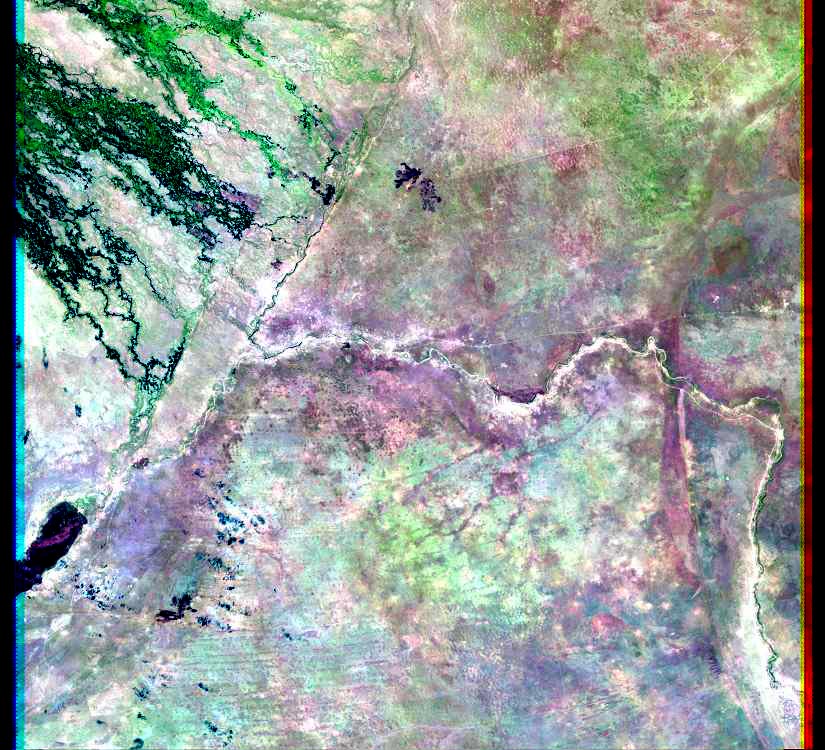
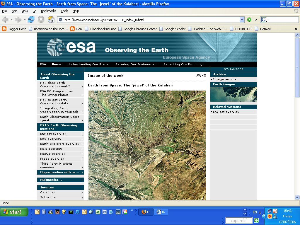
The European Space Agency (ESA)'s Observing the Earth site has made a satellite picture of the Okavango Delta its Image of the Week today, while visiting American K-12 teachers from the Oregon Geographic Alliance, a program that works to improve and increase geography education in that state, toured HOORC and learned how GIS tools are helping to provide information to manage the Okavango region.