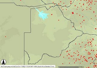
Flying over the Okavango Delta on the weekend, the skeletal outlines of downed, burnt trees were clearly visible: their white ash remains like reverse shadows of trees still standing. Veld fires burning at the eastern edge of the Delta Ramsar site have been extinguished by early rains. You can now track such fires through an online resource, Web Fire Mapper: Botswana. The University of Maryland's Department of Geography is cooperating with the Botswana
Department of Forestry and Range Resources, with the assistance of NASA and MODIS, to produce an online mapping service for wildfires in Botswana. You can use the resource to create online maps that include rivers, protected areas, roads and firebreaks, and track fires by year, the past seven days and the last 48 hours.
No comments:
Post a Comment